🛒 Buy 2 Maps, Get 3rd Map Free!
📦 Free Shipping On All Orders
🚚💨 Fast Delivery From The USA!
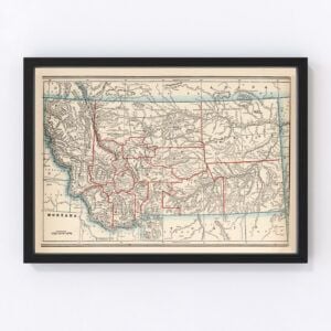
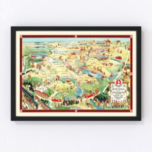
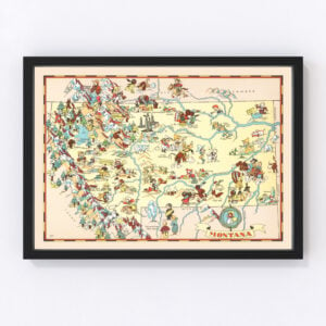
Vintage Montana Maps
The western state of Montana, known for its diverse wilderness and wide-open spaces, took statehood in 1889 (it was the 41st state admitted to the Union).
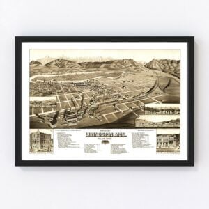
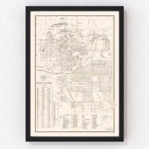
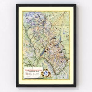
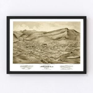
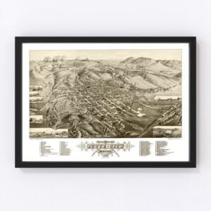
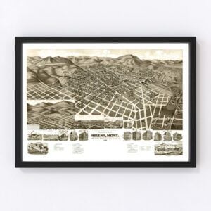
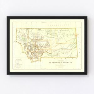
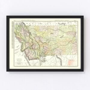
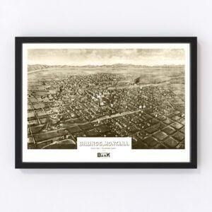
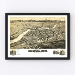
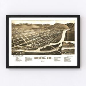
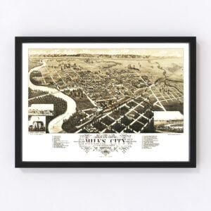
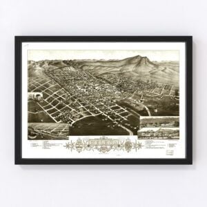
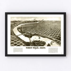
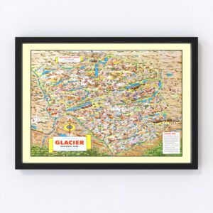
Our historic map archives include vintage maps of the entire state of Montana, Glacier National Park, and city maps including Billings, Butte City, Great Falls, Helena, Livingston, and Missoula.
If you’re looking for a specific Montana map and don't see it on this page, contact us, and we’ll check our archives. While we have an extensive collection of vintage maps, there remain many more we still need to restore, and chances are, we'll have what you're looking for.
About Montana
Native Americans were the first inhabitants of what’s now known as Montana. Some of the tribes that lived on the land included the Assiniboine, Blackfeet, Cheyenne, Crows, Gros Ventres, Kalispel, Kootenai, Pend d’Oreille, and Salish. Today, 12 tribal nations are living on Montana Indian reservations.
In the early 1800s, the Lewis and Clark Expedition crossed the land, and fur trappers and traders quickly followed. Roman Catholic missionaries arrived as well and established missions—St. Mary’s Mission was the state’s first permanent European settlement. And by the mid-1800s, boomtowns began springing up once gold was discovered in the region. Cattle ranches soon followed as the demand for beef increased, especially in the mining towns. In 1864, Montana became a U.S. territory and then in 1889 became the 41st state.
Cattle ranching is still central to Montana’s economy today, and there are actually more cows than people in the state. Forestry, mining, energy production, and the service sector are also major economic drivers. Montana also has a robust outdoor recreation economy due to its vast expanses of wild, untamed land. And, of course, Glacier National Park and Yellowstone National Park (which extends into Montana) are huge tourist magnets.
Montana's also world-renowned for its outstanding fly fishing in the most beautiful, majestic of settings. You might recall the famous fly fishing movie A River Runs Through It starring Brad Pitt. The 1992 film, directed by Robert Redford, was shot in Montana, and some of the stunning and serene river scenes were filmed on portions of Yellowstone, Gallatin, and Boulder Rivers.
Montana’s wildlife is impressive—grizzly bears (the state animal), foxes, wolves, elk, antelope, moose, golden eagles, snow geese, white pelicans, and trumpeter swans are just a few of what you’ll find throughout the state. It’s also one of the few places where you can see free-roaming buffalo.
Finally, in 1876, before Montana was later admitted to the Union, one of the most infamous battles in U.S. history took place in the territory. The Battle of Little Bighorn, also known as “Custer’s Last Stand,” pitted troops led by Lieutenant Colonel George Armstrong Custer against the Lakota Sioux and Cheyenne. The tribes’ leaders, Sitting Bull and Crazy Horse, vehemently resisted an order to move to Indian reservations, and the conflict came to a head on June 25, 1876, near the Little Bighorn River. The tribes’ warriors highly outnumbered Custer’s forces. The battle lasted less than 20 minutes, and Custer and his men were killed.

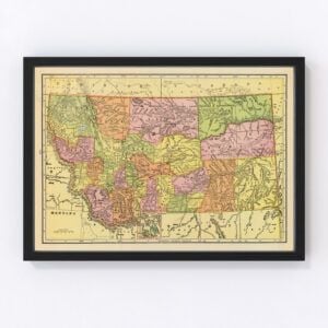
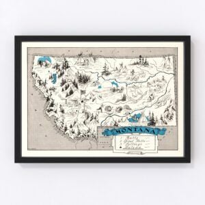


Vintage Montana Maps
The western state of Montana, known for its diverse wilderness and wide-open spaces, took statehood in 1889 (it was the 41st state admitted to the Union).
Our historic map archives include vintage maps of the entire state of Montana, Glacier National Park, and city maps including Billings, Butte City, Great Falls, Helena, Livingston, and Missoula.
If you’re looking for a specific Montana map and don't see it on this page, contact us, and we’ll check our archives. While we have an extensive collection of vintage maps, there remain many more we still need to restore, and chances are, we'll have what you're looking for.
About Montana
Native Americans were the first inhabitants of what’s now known as Montana. Some of the tribes that lived on the land included the Assiniboine, Blackfeet, Cheyenne, Crows, Gros Ventres, Kalispel, Kootenai, Pend d’Oreille, and Salish. Today, 12 tribal nations are living on Montana Indian reservations.
In the early 1800s, the Lewis and Clark Expedition crossed the land, and fur trappers and traders quickly followed. Roman Catholic missionaries arrived as well and established missions—St. Mary’s Mission was the state’s first permanent European settlement. And by the mid-1800s, boomtowns began springing up once gold was discovered in the region. Cattle ranches soon followed as the demand for beef increased, especially in the mining towns. In 1864, Montana became a U.S. territory and then in 1889 became the 41st state.
Cattle ranching is still central to Montana’s economy today, and there are actually more cows than people in the state. Forestry, mining, energy production, and the service sector are also major economic drivers. Montana also has a robust outdoor recreation economy due to its vast expanses of wild, untamed land. And, of course, Glacier National Park and Yellowstone National Park (which extends into Montana) are huge tourist magnets.
Montana's also world-renowned for its outstanding fly fishing in the most beautiful, majestic of settings. You might recall the famous fly fishing movie A River Runs Through It starring Brad Pitt. The 1992 film, directed by Robert Redford, was shot in Montana, and some of the stunning and serene river scenes were filmed on portions of Yellowstone, Gallatin, and Boulder Rivers.
Montana’s wildlife is impressive—grizzly bears (the state animal), foxes, wolves, elk, antelope, moose, golden eagles, snow geese, white pelicans, and trumpeter swans are just a few of what you’ll find throughout the state. It’s also one of the few places where you can see free-roaming buffalo.
Finally, in 1876, before Montana was later admitted to the Union, one of the most infamous battles in U.S. history took place in the territory. The Battle of Little Bighorn, also known as “Custer’s Last Stand,” pitted troops led by Lieutenant Colonel George Armstrong Custer against the Lakota Sioux and Cheyenne. The tribes’ leaders, Sitting Bull and Crazy Horse, vehemently resisted an order to move to Indian reservations, and the conflict came to a head on June 25, 1876, near the Little Bighorn River. The tribes’ warriors highly outnumbered Custer’s forces. The battle lasted less than 20 minutes, and Custer and his men were killed.