🛒 Buy 2 Maps, Get 3rd Map Free!
📦 Free Shipping On All Orders
🚚💨 Fast Delivery From The USA!
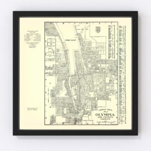
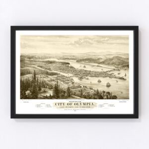
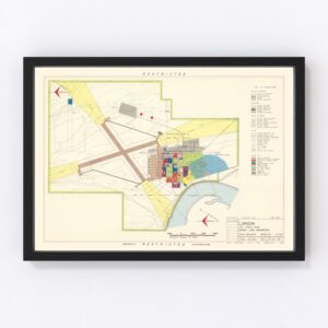
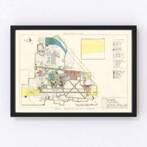
Vintage Washington, D.C. Maps
The nation’s capital of Washington, D.C., was founded in 1790, and in the Ted’s Vintage Art archives we have a collection of beautiful old maps, many in color, that illustrate its history.
If there’s a specific Washington, D.C., map you’re looking for that you don’t see here, let us know, and we’ll check our archives. While our collections of vintage maps are extensive, there are still many more we’re restoring, and we’ll likely have what you’re seeking.
About Washington, D.C.
Washington, D.C., is not a state but a 68-square-mile federal district formed to serve as the U.S. capital. It was named for the first president of the United States, George Washington, and the famous explorer, Christopher Columbus.
Although named in his honor, George Washington never lived in Washington, D.C. He did select the site for the White House but died a year before it was completed. John Adams, the second President of the United States, was the first to live there. Every president except for Washington has lived in the White House.
Unfortunately, a couple of decades after it was built, the British set the White House on fire during the War of 1812. It was rebuilt, and expansions were later added over the years. Also, President Theodore Roosevelt spearheaded a major renovation in 1902, and the White House was then renovated 50 years after that by President Harry S. Truman.
Today, the White House has nearly 55,000 square feet of space spread across six levels. It contains 132 rooms, 35 bathrooms, eight staircases, and three elevators. But, of course, there are also hidden spaces, such as underground tunnels and a nuclear fallout shelter, that the public never sees.
The district is home to the White House and the U.S. Capitol, where the Senate and House of Representatives meet, and the Supreme Court building. Landmarks include the Martin Luther King, Jr. Memorial, Lincoln Memorial, Washington Monument, and Jefferson Memorial, all of which are located along the National Mall. This two-mile-long park attracts millions of visitors each year.
Come springtime, the District of Columbia, briefly transforms into a billowy white and pink landscape when the district’s more than 3,700 cherry trees bloom. The cherry blossoms (symbolizing spring, renewal, and the fleeting nature of life) begin to fall around two weeks after they peak. The trees were gifted to the U.S. in 1912 by the mayor of Tokyo.
When it comes to the economy, the federal government is obviously at the top of the list in Washington, D.C. Tourism comes in second, with nearly 20 million people visiting the district annually. Other industries that contribute to its economy are education, scientific research, and finance.
Finally, although Washington, D.C., is a bustling city, you might be surprised to learn that it’s also home to a diverse mix of wildlife. You might see deer, coyotes, raccoons, foxes, bald eagles, bats, blue herons, and even venomous copperhead snakes!